Making model landscapes

Gary McGuigan showing the TMI team how his interactive models work.
The Mulloon Institute is delighted to be working with Gary McGuigan – one of our artist collaborators on the Citizen Science project and a landowner in the Capertee Valley. Our team recently met up with him to workshops some different interactive features.
Gary makes intricate, interactive and surprisingly robust models of catchment landscapes which are designed to support all sorts of hydrological demonstrations. His current project is a model of the Mulloon Catchment, illustrating landscape rehydration strategies which have transformed the landscape. CAD designs are also currently being finalised. The completed model, which is being supported by funding from the Australian Government, will fit into the boot of a car, so it can travel with us as we work with schools and communities around Australia.


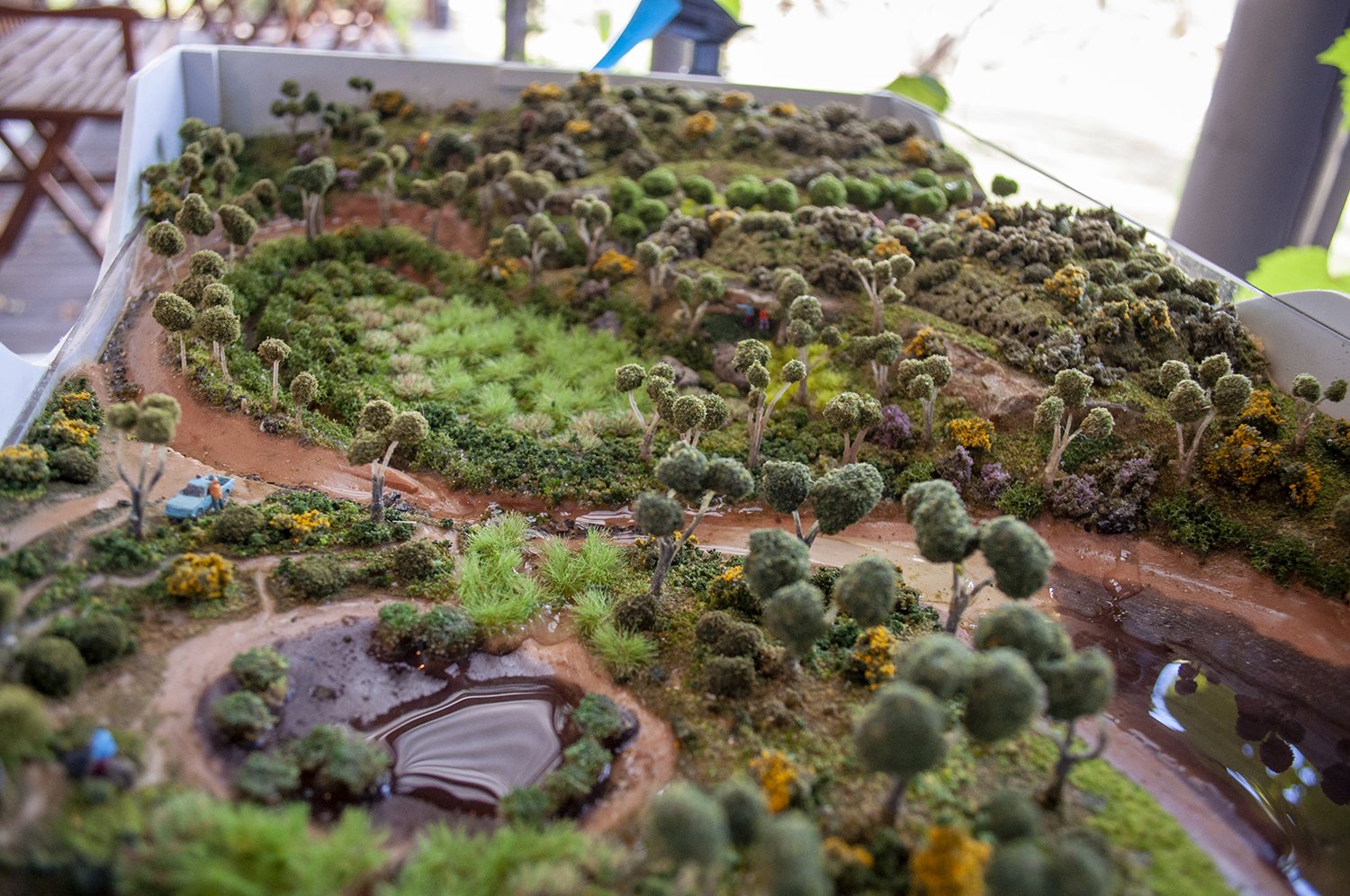

Last year a very eager crowd of catchment model-builders had a fantastic time working with Gary, Laura, Tam and Joe during our Citizen Science workshop in the Capertee Valley. Referencing satellite imagery, we made clay models of a degraded floodplain pocket in three states of being: as it is now, as it may have been pre-agriculture, and as we imagined it could be with some landscape rehydration. These activities make for terrific educational activities using natural materials, and we look forward to taking it out on the road.

Building interactive catchment models in Capertee Valley, NSW.
This Citizen Science project received grant funding from the Australian Government. The clay modelling workshop was part of a three-day Land Studio camp, which was funded by the NSW Government through its Increased Resilience to Climate Change Community Grants Program. Land Studio is an initiative of the art cooperative Kandos School of Cultural Adaptation (KSCA), of which Laura Fisher is a member.