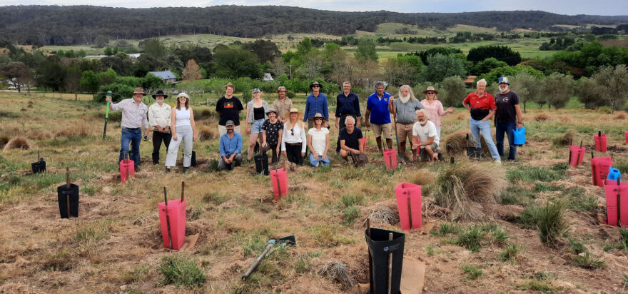
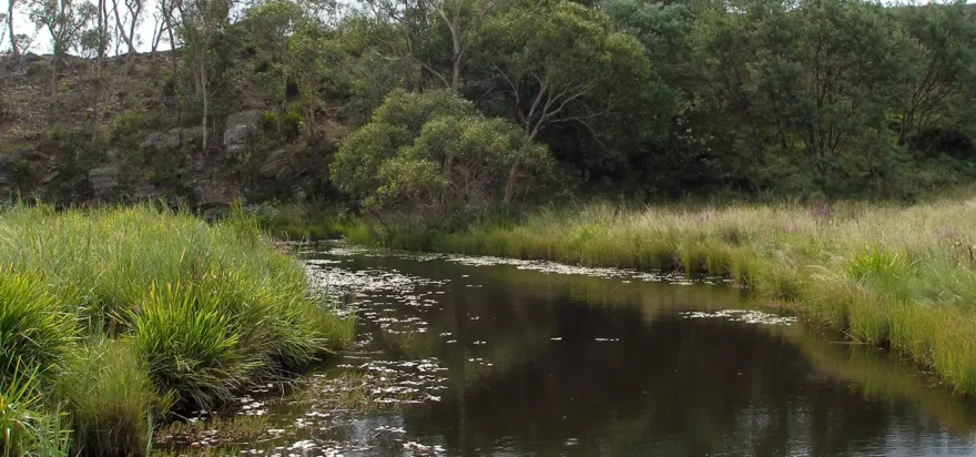
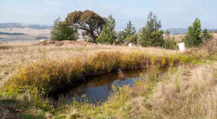
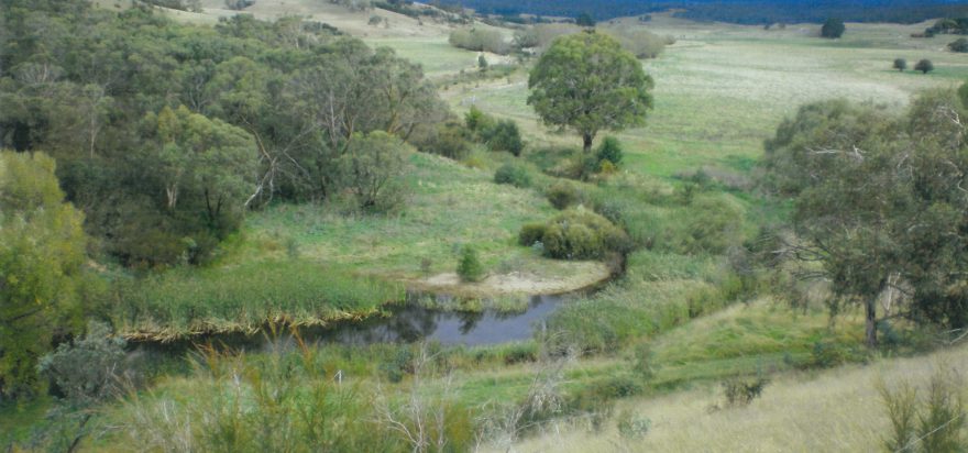
Catch Water, Restore Land

Rehydrating AustraliaN LANDSCAPES

The Mulloon Institute is rehydrating and regenerating landscapes across Australia for improved agricultural productivity, enhanced environmental biodiversity, improved habitat for threatened species, and greater community resilience to drought, bushfire and flood.

For the biggest positive impact and significant ongoing results, we’re collaborating with local farmers and regional community groups to undertake this work.

Education is the biggest key to expanding landscape rehydration across this country and helping address environmental degradation and climate change.

PROJECT Outcomes

  • Reducing impact of climate change impacts.

  • Enhancing food and water security.

  • Increasing environmental biodiversity.

  • Improving water quality and availability.

  • Healthier, nutrient dense food leading for healthier people.

  • Improved resilience to natural disasters.

  • Improved farmer productivity and profitability, in long-term.

  • Viable rural and regional communities.

Please support our project:
‘Catch Water, Restore Land’!


Mulloon Rehydration Initiative

LOCATION: SOUTHERN TABLELANDS, NSW
SIZE: 23,000 HA
PARTICIPANTS: 23 LANDHOLDERS

Mulloon Rehydration Initiative Catchment Map (link to interactive map)

Westview Farm, 2018

Westview Farm, 2020

The Mulloon Rehydration Initiative is a catchment-scale project that aims to rebuild the natural landscape function of the Mulloon catchment and boost its resilience to climatic extremes for more reliable stream flows, improved ecosystem functioning and enhanced agricultural productivity. Includes development and implementation of a comprehensive Integrated Monitoring Plan.

The Mulloon Rehydration Initiative is a model for landscape scale repair across Australia which has led to increased productivity, biodiversity and soil fertility and soil organic carbon, improved water quality and quantity and resilience to climatic extremes. The results of the project reflect healthier landscapes and the production of high quality, nutrient dense food.


CHALLENGE

At Mulloon Creek, widespread land degradation had been caused by nearly 200 years of European land use, including agriculture, forestry and mining. The deep and chronic erosion of creeks and gullies has lowered the water-table, dried up wetlands and dramatically reduced the water holding capacity of the soils. Just like pulling the plug out of a bathtub.

OPPORTUNITY

The Mulloon Institute is working in partnership with the Mulloon catchment community to reverse these threats, through catchment-scale rehydration of the waterway and recreation of habitat through revegetating aquatic and terrestrial areas. This is building whole landscape resilience due to increased and prolonged water and moisture levels, preventing future environmental damage, improving biodiversity and restoring and protecting habitat. Improved ecosystem function also improves soil health, as well as ground and surface water quality and availability through the filtering of sediments and recycling of nutrients. 

Increased soil moisture combined with managed grazing approaches can increase soil carbon levels. This combined with the reinstatement of wetlands – traditional carbon sinks – can assist in sequestering carbon from the atmosphere and so contribute to addressing the global challenge of climate change.

Bringing the community along

Catchment-scale projects are inherently social projects that begin with the education and capacity building of communities on the process of landscape rehydration and associated regenerative land management approaches. The Mulloon Rehydration Initiative has developed a ‘bringing the community along’ approach to ensure that all stakeholders, including landholders, regulators, researchers and the broader community, can engage with the project.

Baseline studies

The Mulloon Institute and its partners are undertaking a suite of biophysical, social and economic baseline studies within the catchment. The overarching integrated monitoring plan will enable the impacts of the restoration and rehabilitation work to be monitored in the long-term and demonstrate the crucial link between environmental, social and economic aspects of landscape repair. This valuable research will be shared publicly and this project will be used as a model of implementation in order to facilitate similar projects across Australia.

Dr Dan Starrs from the Australian National University helping conduct the fish survey.

Dr Dan Starrs from the Australian National University helping conduct the fish survey.

Scientific baseline surveys were conducted prior to the Mulloon Rehydration Initiative being implemented to monitor the project’s impact on Mulloon Creek and the surrounding catchment. Ongoing monitoring is also being conducted during the project to monitor changes.

Threatened species

The Mulloon Rehydration Initiative demonstrates the benefits of landscape scale repair and restoration works that have resulted in the sustained baseflow of Mulloon Creek. The waterway now has increased water quality and restored spongy wet floodplains which are more productive and provide valuable habitat for threatened and vulnerable species, including the Scarlet Robin, Diamond Firetail, and Dusky Wood Swallow. The project area forms a critical biodiversity corridor by connecting the Tallaganda National Park with the protected State Reserve of the Mid-Shoalhaven Water Catchment.


Future

The Mulloon Rehydration Initiative is a long-term, catchment-wide project. It is a key focus for the Mulloon Institute, which is coordinating activities for 23 landholders, ten government agencies, several local environmental groups and universities, as well as a wide community of interest spanning the country. This unique and collaborative community project is the only one of its kind in Australia and highlights the social nature of catchment scale projects, with a wide range of stakeholders involved.


Acknowledgements

The Mulloon Institute has been recognised by the United Nations Sustainable Solutions Network as being one of five projects globally, as a demonstrator of sustainable, profitable and productive farming. The Mulloon Rehydration Initiative is jointly funded through the Mulloon Institute and the Australian Government’s National Landcare Program and is supported by the NSW Government’s Environmental Trust.

Case studies


Natural Sequence Farming Pilot Project

In 2005, our late Founder Tony Coote AM and his wife Toni invited innovative landscape thinker Peter Andrews OAM to their property at Mulloon Creek Natural Farms. That first meeting of minds led to a union which transformed Tony’s property and the deeply eroded creek that ran through it.

Landscaping works began along 3kms of Mulloon Creek in 2006, with the objective of slowing the flow, raising the creek’s water level, de-energising and spreading flood waters, and reinvigorating the floodplain. This included installing a series of erosion control structures (living leaky weirs), fencing to exclude stock and wildlife, and planting of thousands of trees, shrubs, reeds and rushes. The project was supported and supervised by Southern Rivers Catchment Management Authority and co-funded by the National Landcare Program

Monitoring

Stream gauges were installed above and below the project site and piezometers were set up throughout the floodplain, allowing us to measure changes to the system’s hydrology (stream flow, groundwater and rainfall).

Monitoring has shown an overall improvement to the creek’s flow as it discharges from the project site with the creek maintaining its flow during dry times.

Raising the creek’s water level has also raised the water level under the floodplain. During wetter periods the floodplain recharges (banks water) to a greater extent than before the project and slowly releases this banked water back into the creek during dry times, sustaining the system downstream. The next wet cycle then replenishes ‘the bank’ again.

Outcomes

The creek has become a healthy, vibrant ecosystem, filtering water through its extensive reed beds, capturing flood sediments, recycling nutrients and providing complex habitat for birds, mammals, reptiles, frogs, fish and invertebrates.

  • increased flora and fauna

  • improved water quality

  • sustained water flow

  • 60% increase in agricultural productivity.

View various shots of BEFORE & AFTER.

REPORTS

Before - Mulloon Creek upstream of Peter's Pond (1977)

After - Mulloon Creek upstream of Peter's Pond (2015)